


VTD-precinct 5, Hughes County, South Dakota
About
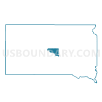
Outline

Summary
| Unique Area Identifier | 667385 |
| Name | VTD-precinct 5 |
| County | Hughes County |
| State | South Dakota |
| Area (square miles) | 149.77 |
| Land Area (square miles) | 149.68 |
| Water Area (square miles) | 0.09 |
| % of Land Area | 99.94 |
| % of Water Area | 0.06 |
| Latitude of the Internal Point | 44.48561480 |
| Longtitude of the Internal Point | -100.02562120 |
Maps


Graphs
Select a template below for downloading or customizing gragh for VTD-precinct 5, Hughes County, South Dakota


Neighbors
Neighoring Voting District (by Name) Neighboring Voting District on the Map
- VTD-precinct 1, Hughes County, SD
- VTD-precinct 2, Sully County, SD
- VTD-precinct 5, Sully County, SD
- VTD-precinct 7, Hughes County, SD
- VTD-precinct 9, Hughes County, SD
Top 10 Neighboring County Subdivision (by Population) Neighboring County Subdivision on the Map
- West Hughes UT, Hughes County, SD (2,437)
- West Sully UT, Sully County, SD (385)
- Blunt city, Hughes County, SD (354)
- East Sully UT, Sully County, SD (254)
- North Hughes UT, Hughes County, SD (250)
- Raber township, Hughes County, SD (26)
Top 10 Neighboring Place (by Population) Neighboring Place on the Map
Top 10 Neighboring Unified School District (by Population) Neighboring Unified School District on the Map
- Pierre School District 32-2, SD (16,064)
- Agar-Blunt-Onida School District 58-3, SD (1,915)
- Highmore-Harrold School District 34-2, SD (1,821)